WEATHER FORECAST
UPDATE: Tropical Storm Erin Continues Strengthening
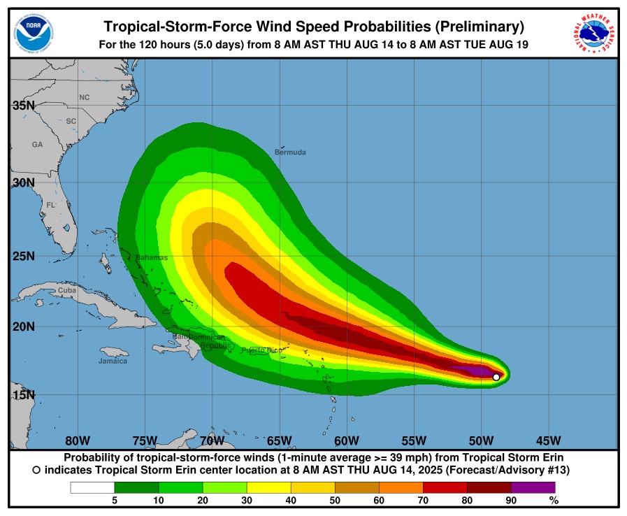
Tropical Storm Erin continues strengthening with maximum sustained winds now at 60 mph and pressure dropping to 999 mb.
The storm is now just 890 miles east of the northern Leeward Islands – significantly closer than yesterday.
Erin is expected to become a HURRICANE tomorrow (Friday) and could reach major hurricane status by the weekend.
The storm’s core will pass near or just north of the northern Leeward Islands this weekend, potentially bringing heavy rainfall, high surf and life-threatening rip currents and tropical-storm force winds.
The storm has also developed 50-mph winds extending 15 miles from the centre, indicating further strengthening.
Erin could intensify to 105-125 mph winds by early next week, creating broader regional impacts.
No watches or warnings yet, but residents should finalise preparations as soon as possible.
Stay with ABS for continuing coverage.

CWI ANNOUNCES SPECIAL PLAN FOR ITS THREE TOP PACERS

SIR MOLWYN JOSEPH PRAISED BY COLLEAGUE LAWMAKERS IN HIS SWANSONG SITTING

OPPOSITION LEADER EJECTED FROM PARLIAMENTARY SITTING AS SPEAKER FLAYS HIM FOR ‘RUDENESS’

PM URGES UPP TO ‘GET IN A STATE OF READINESS’ AS HE ANNOUNCES GENERAL ELECTION BY APRIL

CABINET AGREES TO AIR TRAVEL SUBSIDY BETWEEN ANTIGUA AND BARBUDA
OPPOSITION LEADER EJECTED FROM PARLIAMENTARY SITTING AS SPEAKER FLAYS HIM FOR ‘RUDENESS’

‘Justice For My Bri Bri’ – Grandmother Of Teenager Slain In Villa Reacts

Herberts Man Charged for Smoking Cannabis in Public

Police Question Three Suspects in All Saints Murder Investigation
CWI ANNOUNCES SPECIAL PLAN FOR ITS THREE TOP PACERS